


Shipping:
Free Shipping Included
Delivery:
Estimated 2-15 Business Days
Payments:
Credit Card, Check, Cash, PayPal, Apple Pay, Venmo
Returns:
30 Days 100% Money Back Guarantee, Buyer Pays Return Shipping
Description
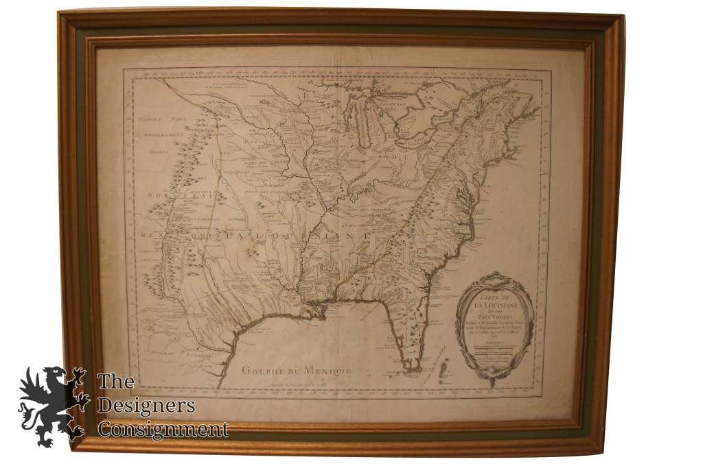
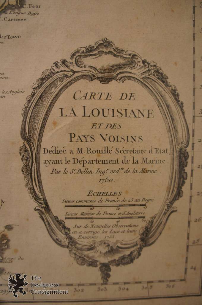
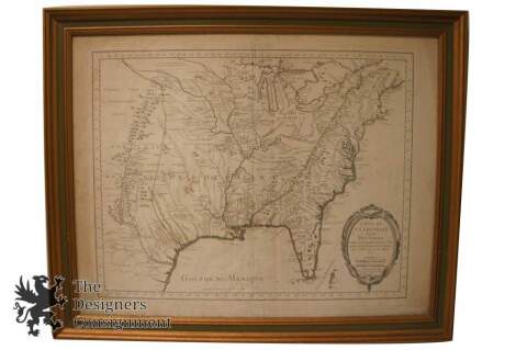
1755 Carte La Louisiane et Des Pays Voisins Dediee a
M. Rouille Secretairr 'd Etat ayant le Departement de la Marine...1750..Sur de Nouvelle
Observations on a corrigee les Lacs, et Leurs Enviorns 1755
#19763-HAR1B
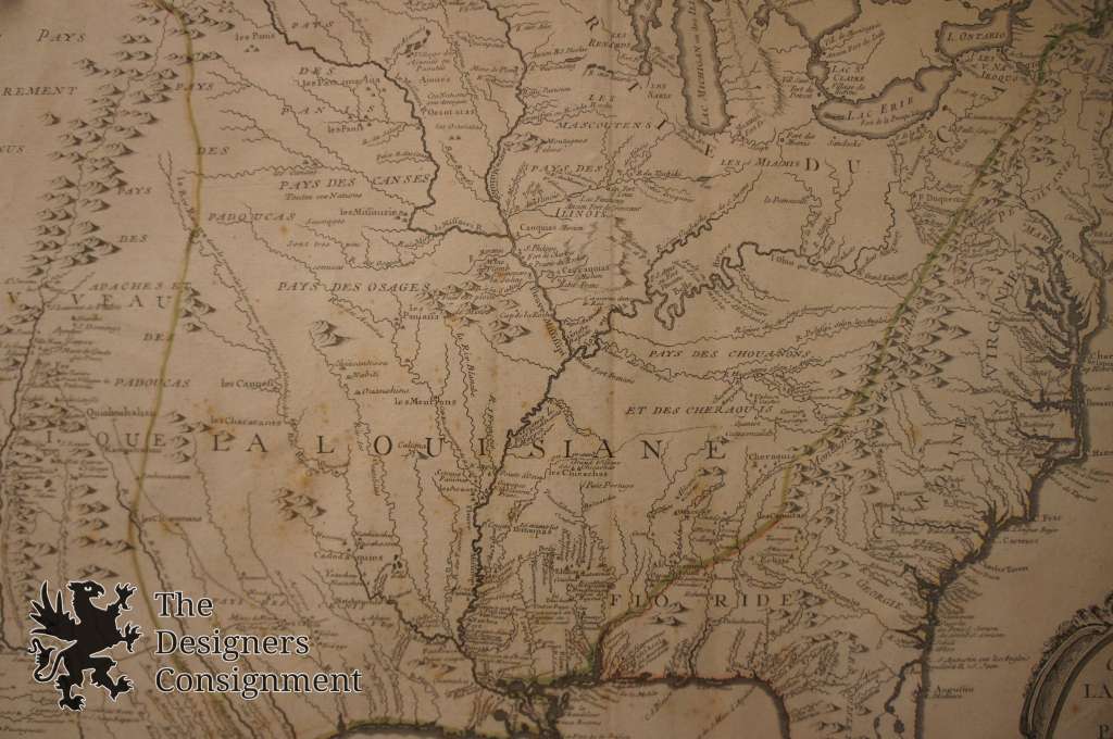
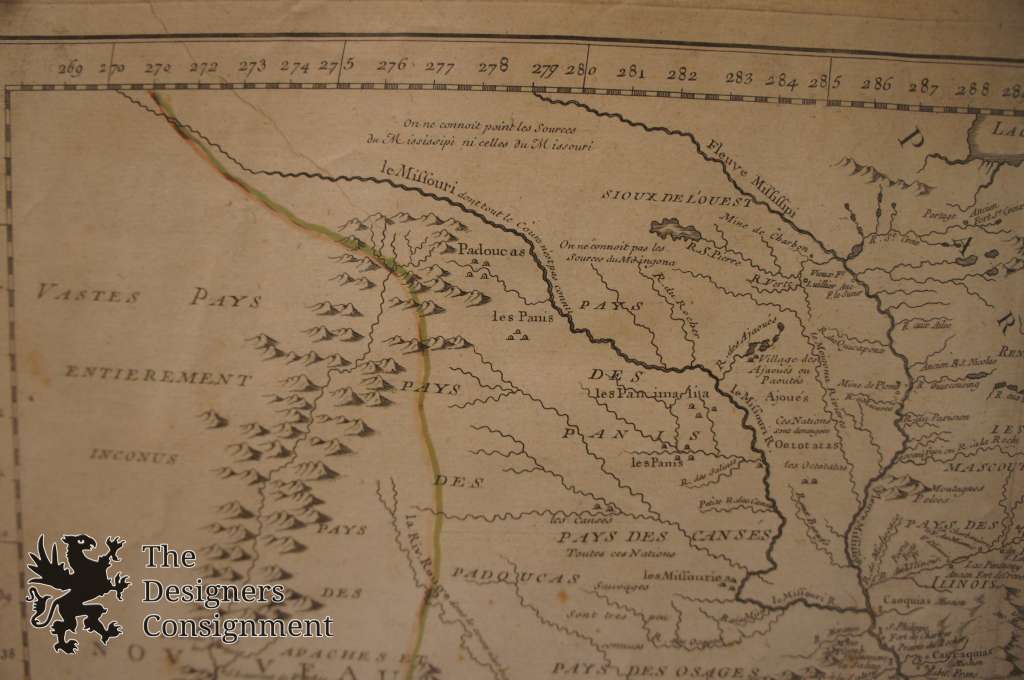
An authentic map by Jacques Nicolas Belllin. The map shows North America from the Eastern Seaboard. Originally published in 1750 for Charlevoix's Histoire et description generale de la Nouvelle France. This example was made 5 years later with an extension noting new corrections and observations ,most notably to the great lakes area.
Map is professionally framed and matted.
Condition
Gently Used - Some Discolored Spots, soiling to the bottom left.
See Pictures for best description
Dimensions
31.25" x 25" x 1"
Sans Frame - 28.25" x 22.25"
(L x W x H)