


Shipping:
Free Shipping Included
Delivery:
Estimated 2-15 Business Days
Payments:
Credit Card, Check, Cash, PayPal, Apple Pay, Venmo
Returns:
30 Days 100% Money Back Guarantee, Buyer Pays Return Shipping
Description
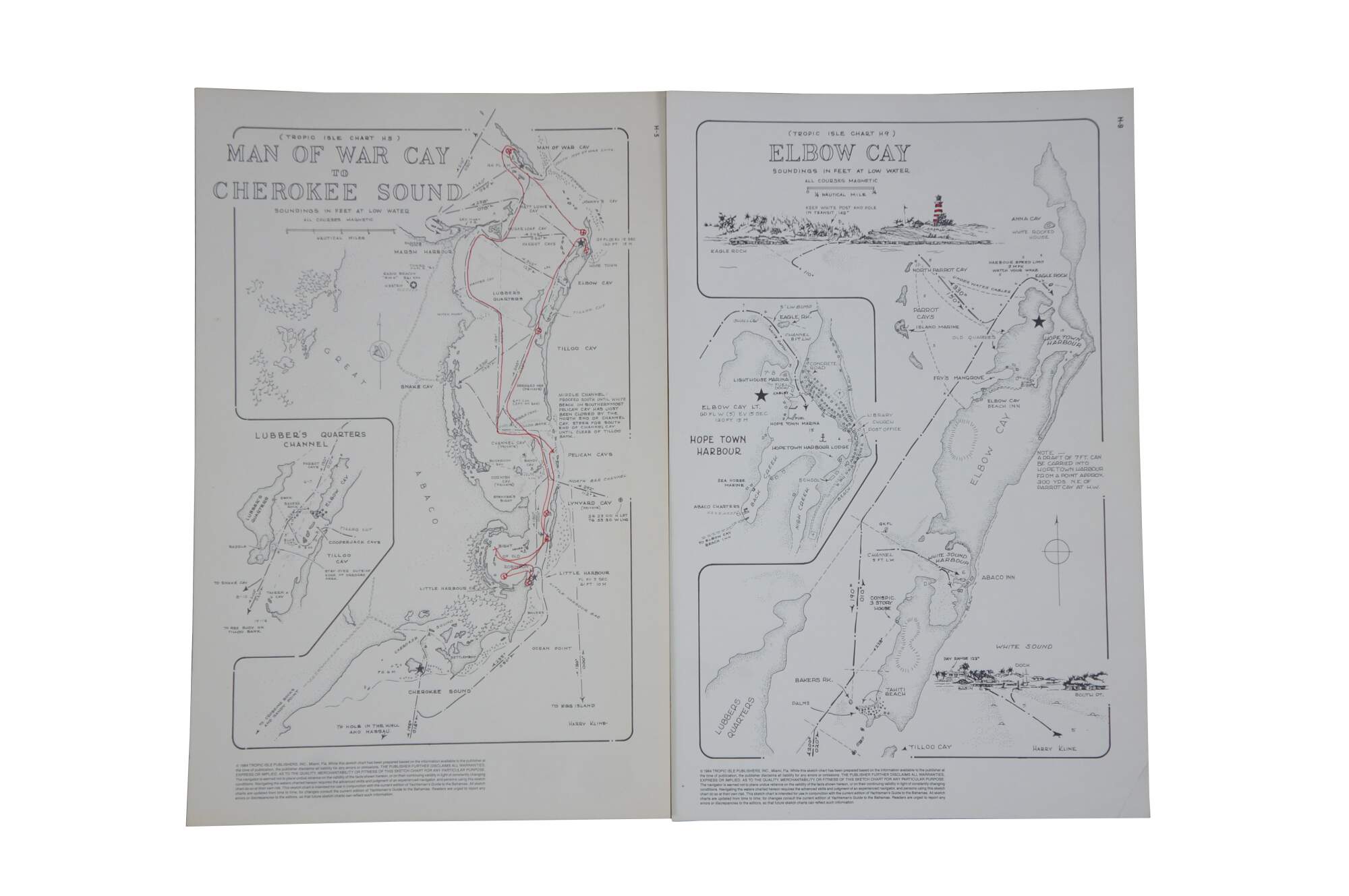
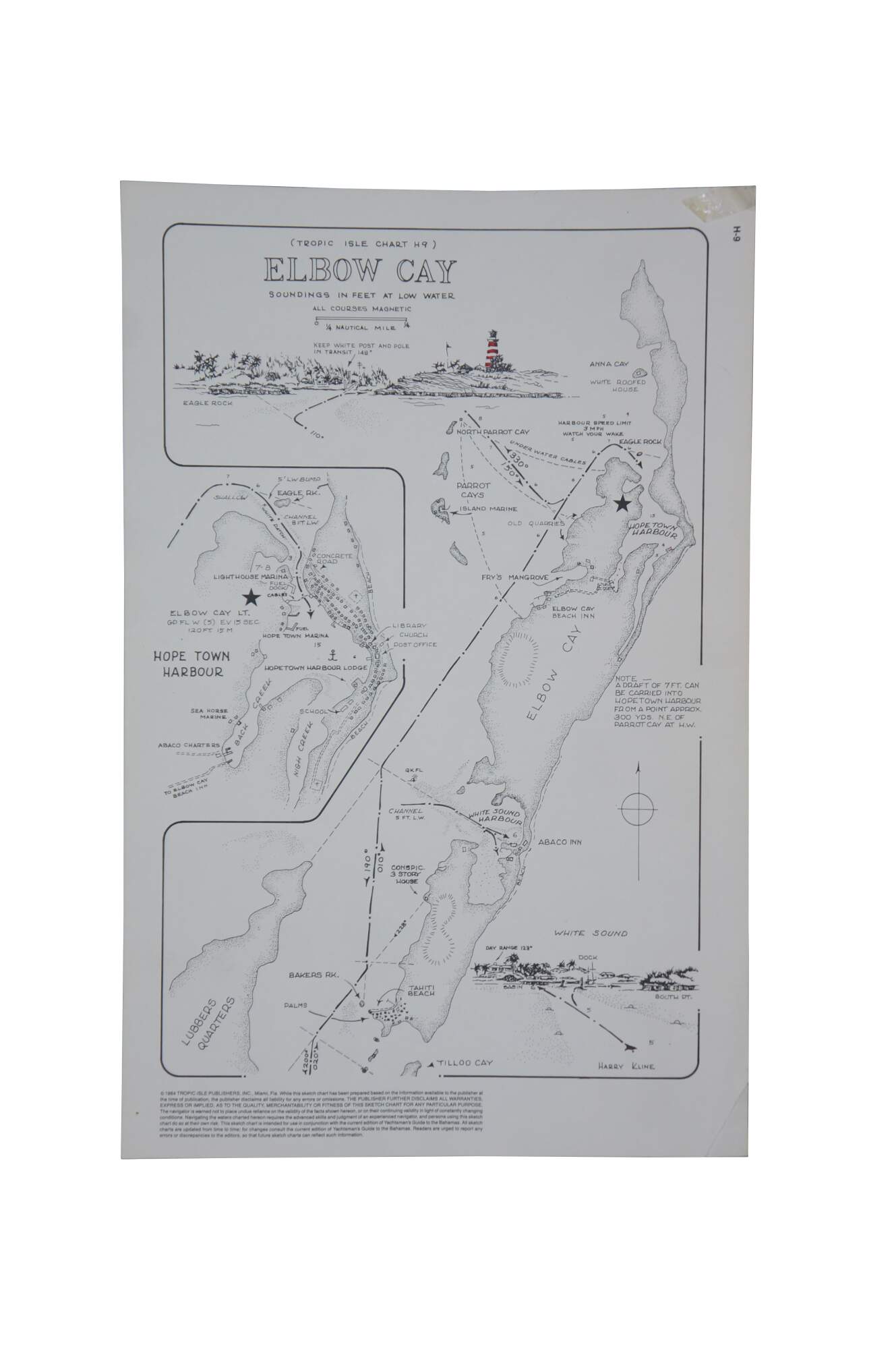
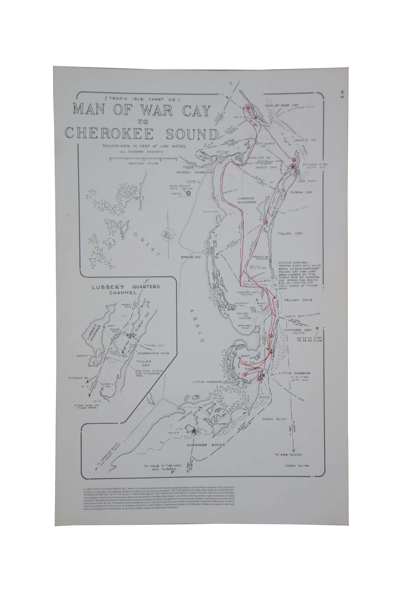
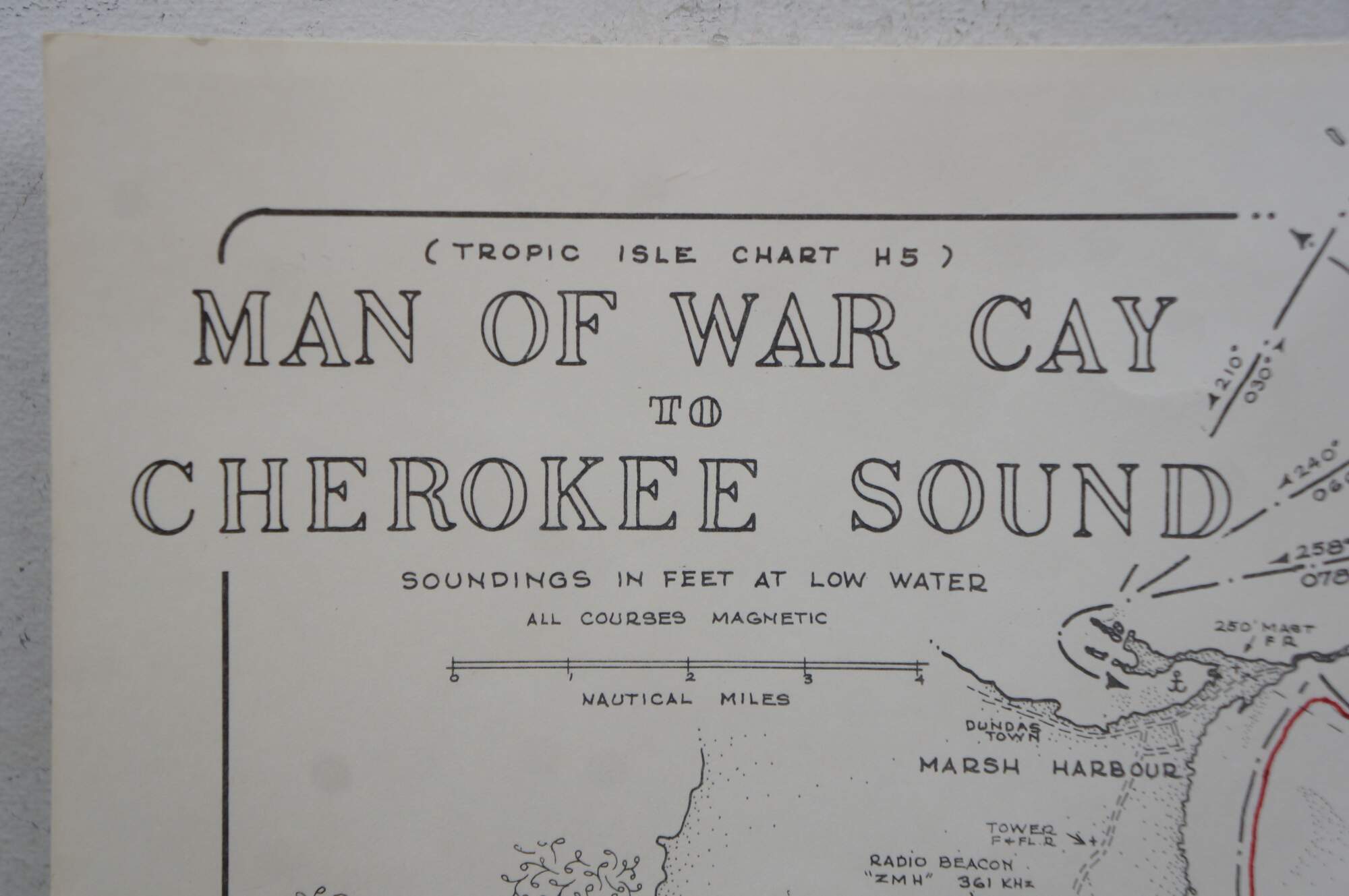
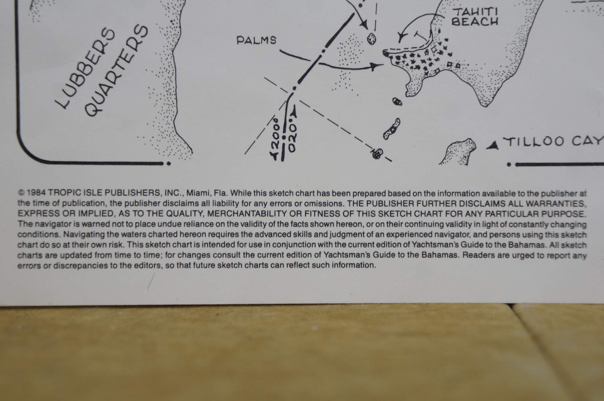
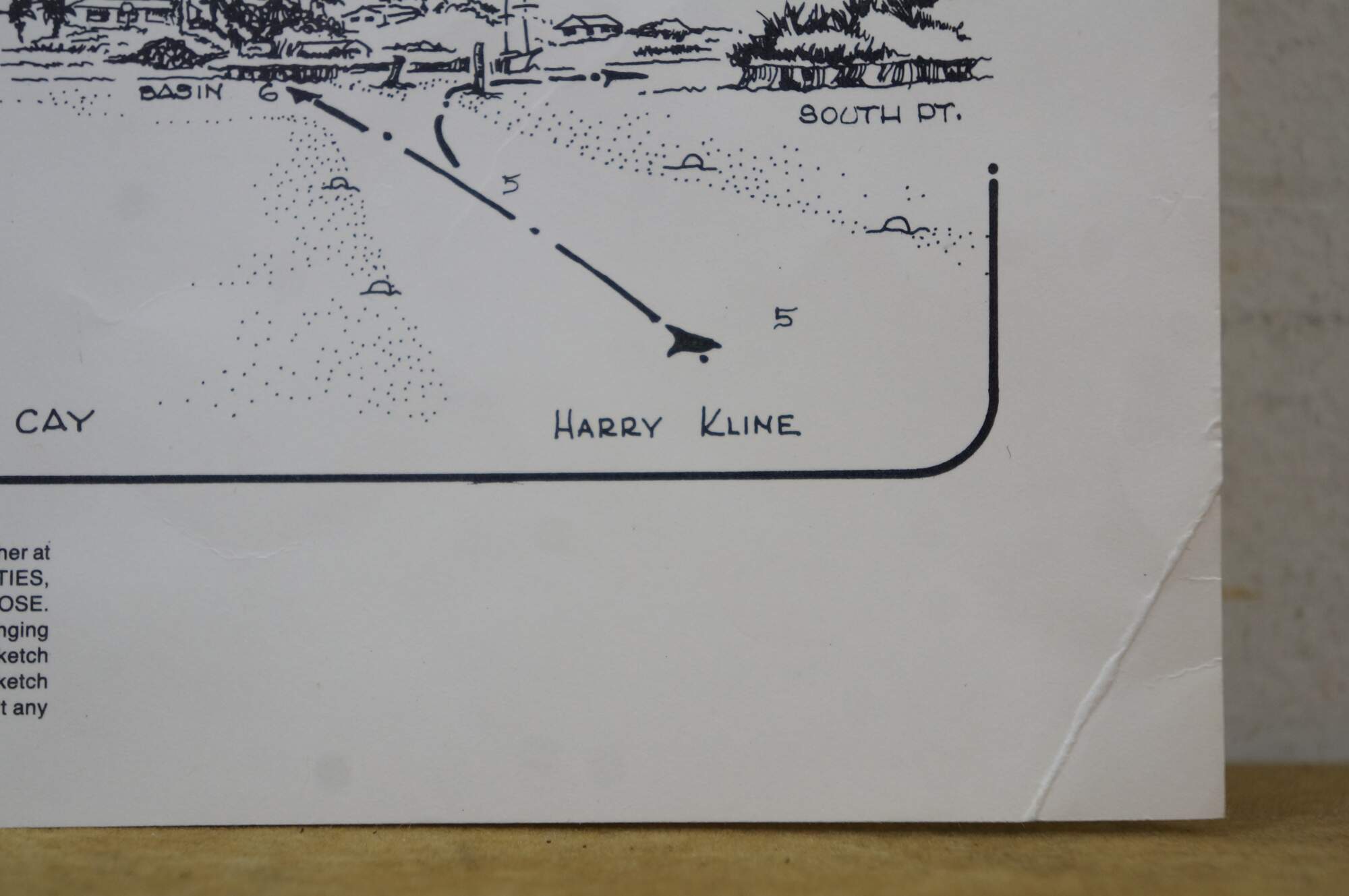
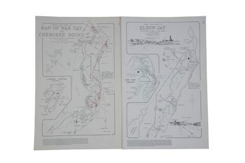
Two vintage navigational charts / maps of Man of War Cay to Cherokee Sound and Elbow Cay. Circa 1984. Tropic Island Publishers. Harry Kline.
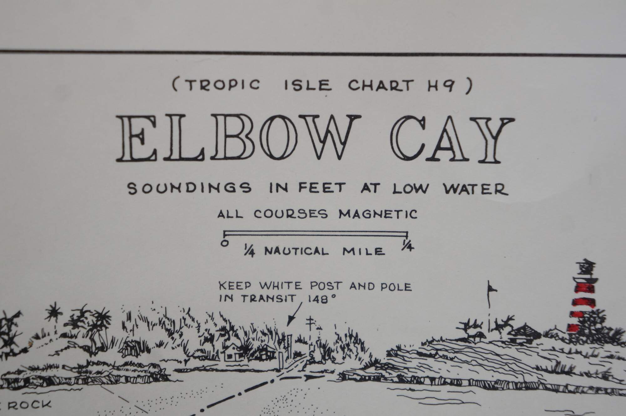
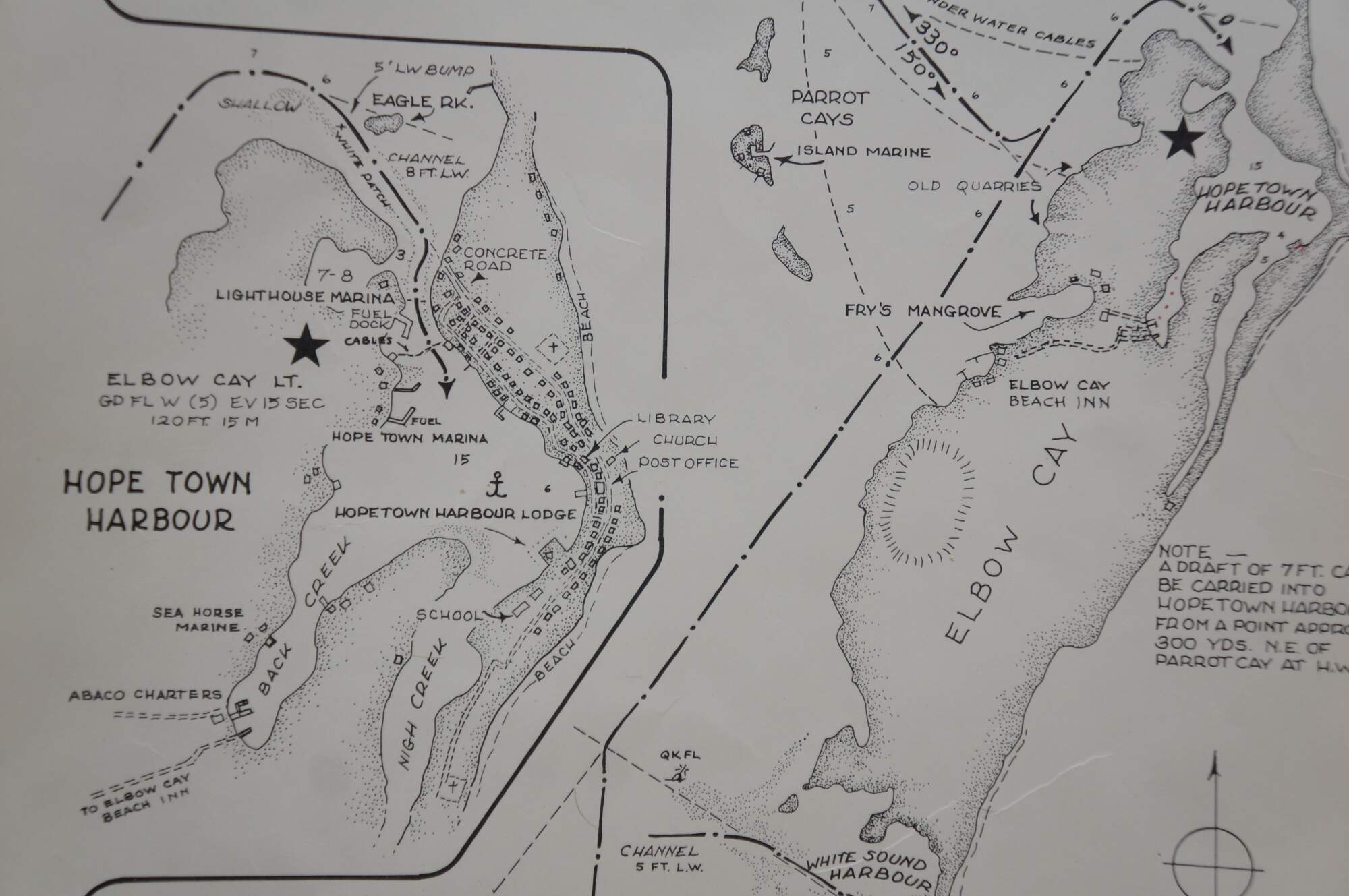
Vintage navigational chart for Elbow Cay in the Bahamas, produced by Tropic Isle Publishers.� It features detailed maps of Elbow Cay, Hope Town Harbour, Eagle Rock and Lobbers Quarters. The chart includes soundings in feet at low water for navigation purposes. It marks specific locations such as the lighthouse and various cays.
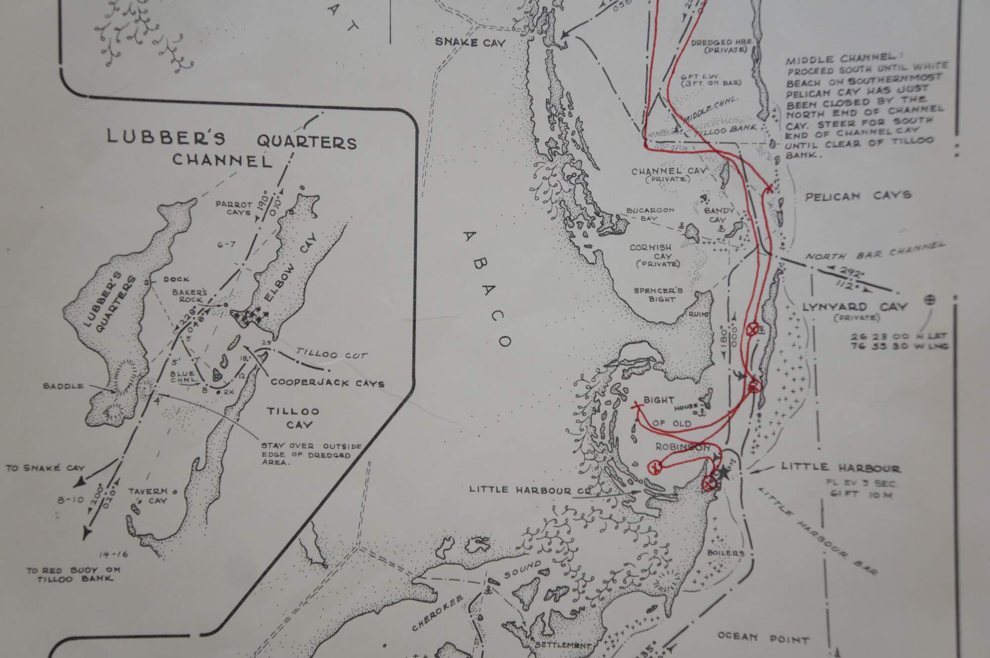
Vintage nautical chart of the Abaco Islands in the Bahamas, specifically covering the area from Man-O-War Cay to Cherokee Sound. It details several cays and landmarks including Great Abaco, Lubber's Quarters, Tilloo Cay, and Pelican Cays. A smaller detailed section on the left focuses on the Lubber's Quarters Channel. Red lines and marks were made at some point to indicate a specific sailing or travel route used by the previous owner. The map includes soundings (depth measurements) in feet at low water and traditional compass roses for navigation.
Condition
Slight discoloration; corner crease
Dimensions
11" x 17" (W x L)