


Shipping:
Free Shipping Included
Delivery:
Estimated 2-15 Business Days
Payments:
Credit Card, Check, Cash, PayPal, Apple Pay, Venmo
Returns:
30 Days 100% Money Back Guarantee, Buyer Pays Return Shipping
Description
MCH 2
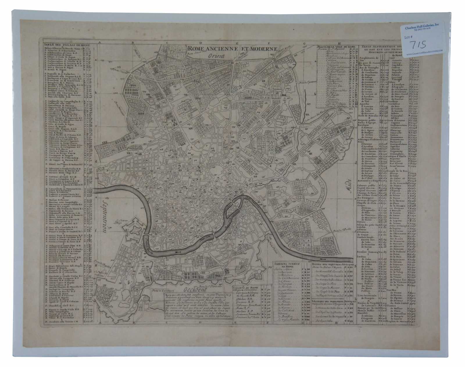
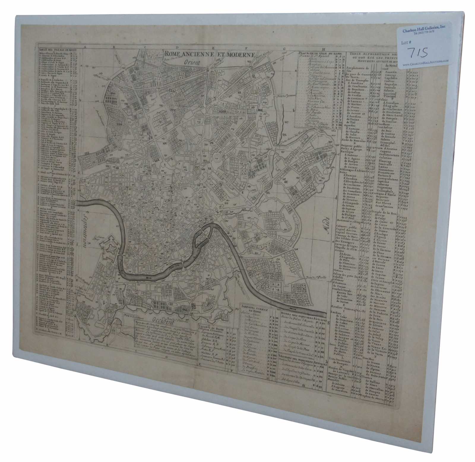
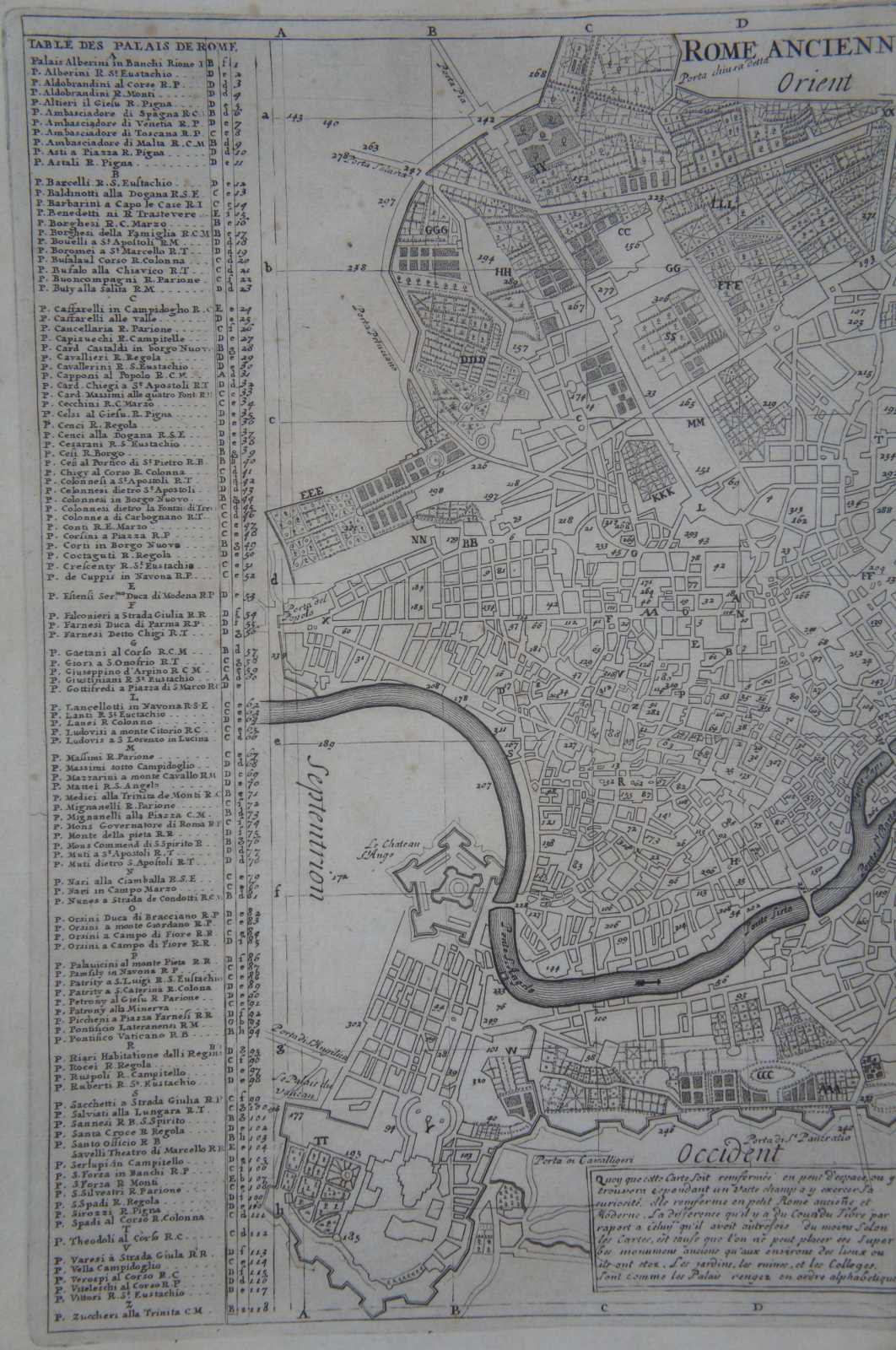
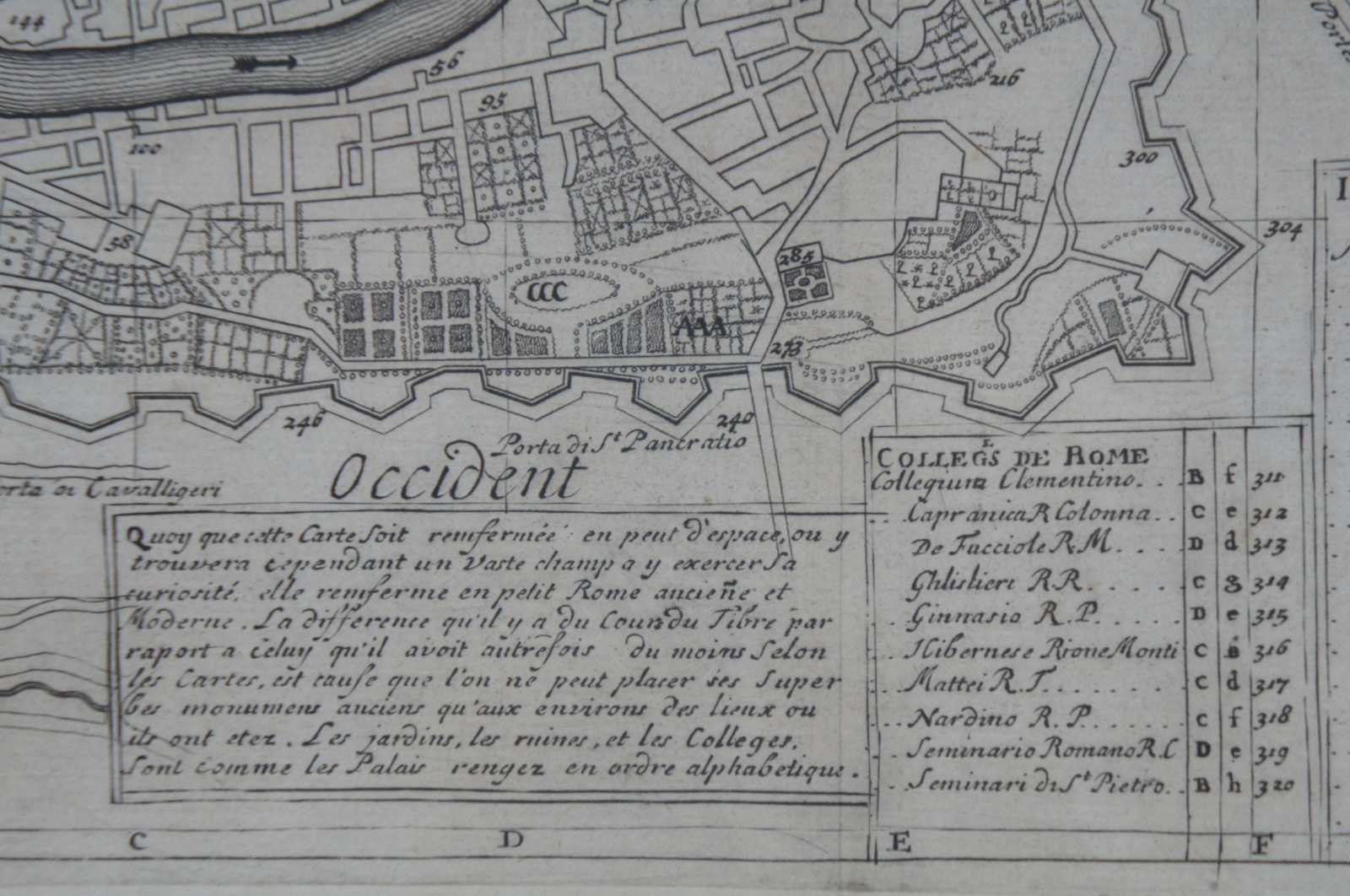
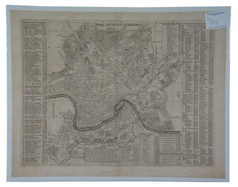
Antique print, titled: 'Rome Ancienne et Moderne.' - This handsome plan of Rome shows the streets, parks, major buildings and the fortifications and ramparts in the southern part of the city below the river. Numerous tables keyed to the map name hundreds of palaces, colleges, gardens, ancient ruins and monuments and other important buildings. Eighteen formal gardens are listed. Engraving on hand laid paper. Description: Atlas Historique.' (Historic Atlas.), Published by Zacharie Chatelain, Amsterdam. The atlas was published in seven volumes between 1705 and 1720, with a second edition appearing in 1732. The maps were accompanied by information pertaining to cosmography, geography, history, chronology, genealogy, topography, heraldry, and costumes of the world. The maps in the Atlas Historique were mainly based on those of the French cartographer, Guillaume De L'Isle, but were presented by the Chatelains in an encyclopaedic form.
Condition
Very Good - light foxing to paper; see pictures
Dimensions
19.25” x 15.25” (Width x Height)