


Shipping:
Free Shipping Included
Delivery:
Estimated 2-15 Business Days
Payments:
Credit Card, Check, Cash, PayPal, Apple Pay, Venmo
Returns:
30 Days 100% Money Back Guarantee, Buyer Pays Return Shipping
Description
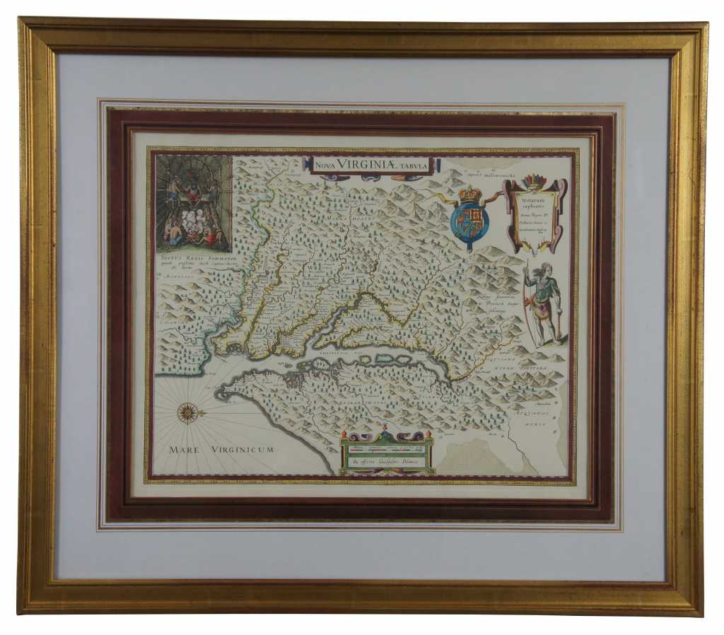
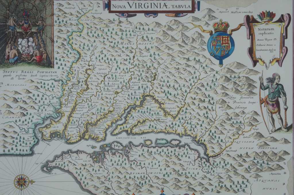
Nice example of Blaeu's map of Virginia, and the Chesapeake region, based upon John Smith's map of Virginia, the most important map of Virginia published in the 17th Century.
This is the second state of Hondius' rare separately issued map, first engraved by Jodocus Hondius in 1618 and purchased by Blaeu following Hondius' death in 1629. The map depicts the discoveries in the region detailed by John Smith in his seminal map of Virginia, first issued in 1612. Because of the commercial success of Blaeu's Atlases, it is Blaeu's map of Virginia which influenced 2 generations of European map makers regarding the English mapping and discoveries in the region. It was the primary influence on other maps of the period and the standard map of the region until Augustine Hermanns map of 1673.
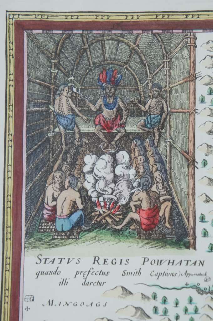
In 1606, the London Company sent its first ship to Virginia and established the Jamestown settlement. Captain John Smith accompanied the English settlers at Jamestown. Between 1607 and 1609, he explored the major rivers which flowed west into the Chesapeake Bay, recording the names of the Native Amercian villages and tribes he encountered. The limits of Smith's explorations are marked with a Maltese cross, which Blaeu incorporates on his map and can typically bee seen at the upper part of each of the rivers depicted on Blaeu's map. Beyond the crosses, Smith relied on Native American accounts to delineate territories further upriver. Smith notes on the map ""To the crosses hath bin discouerd what beyond is by relation.""
Upon Smith's return to England in 1609, Smith employed William Hole to engrave a map, which was first included in a small pamphlet by Joseph Barnes of Oxford in 1612. Jodocus Hondius engraved the first edition of this map in 1618, making it the second appearance of Smith's original manuscript to appear in print. Smith's original map would not appear again until 1624, when it was included, along with Smith's map of New England, in his landmark work, The Generall Historie of Virginia, New-England, and the Summer Isles, in 1624. The following year it was included in Purchas His Pilgrimes.
There is some question as to whether the map is the work of Smith, who led most of the explorations, or the surveyor accompanying him, Nathaniel Powell. The original Smith map can be viewed here: /gallery/detail/23677
An essential map for collectors of this region.
Condition
Very Good – See pictures
Dimensions
29.5” x 25.5” x 1.25” / Sans Frame - 19.5” x 15.625” (Width x Height x Depth)