


Shipping:
Free Shipping Included
Delivery:
Estimated 2-15 Business Days
Payments:
Credit Card, Check, Cash, PayPal, Apple Pay, Venmo
Returns:
30 Days 100% Money Back Guarantee, Buyer Pays Return Shipping
Description
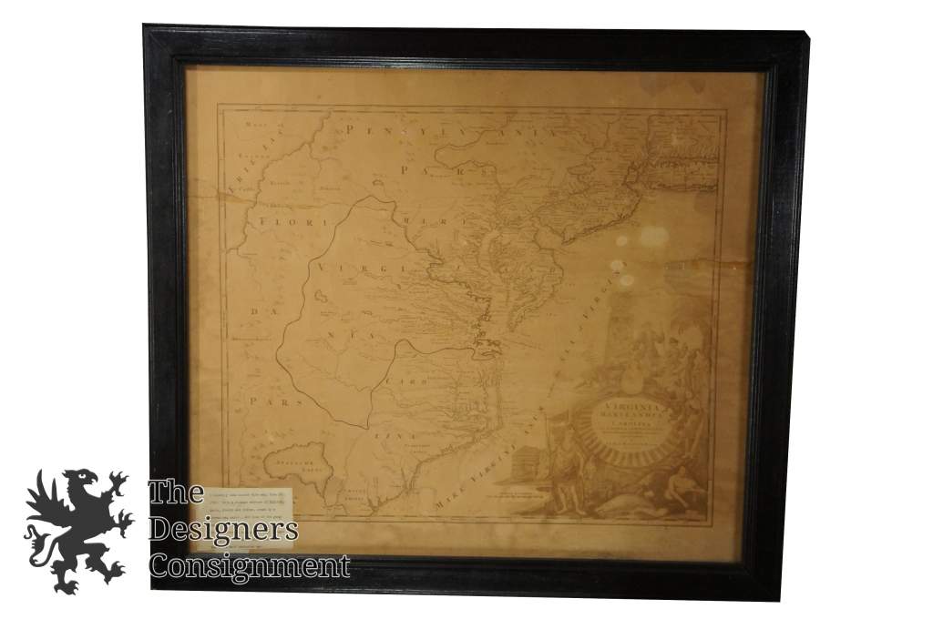
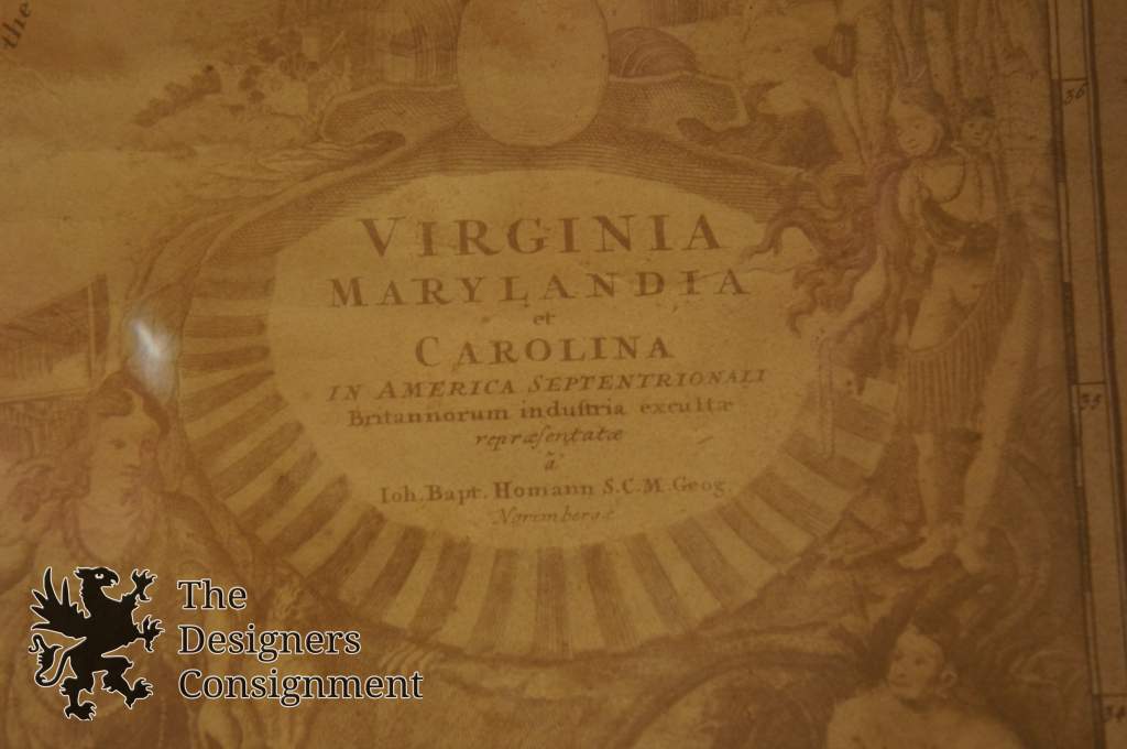
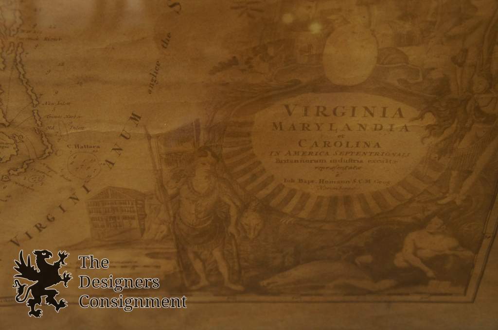
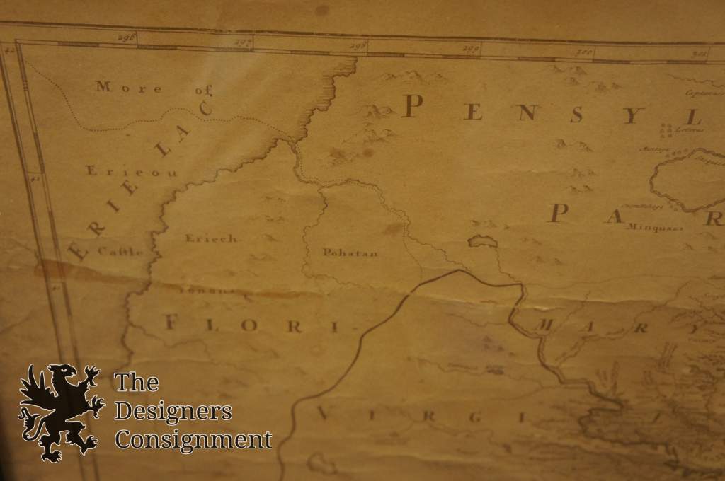
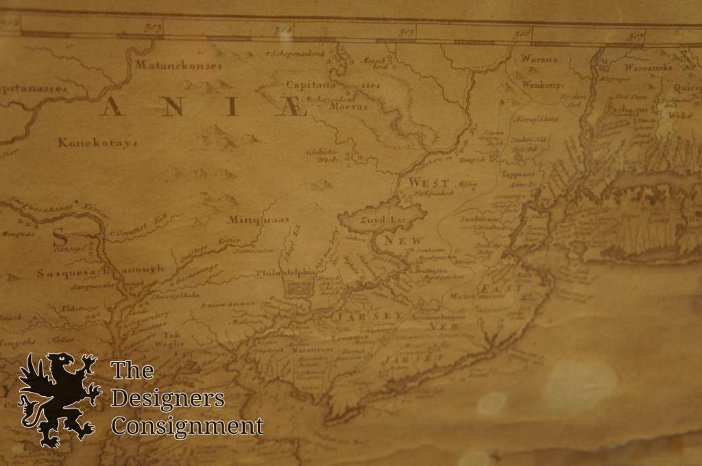
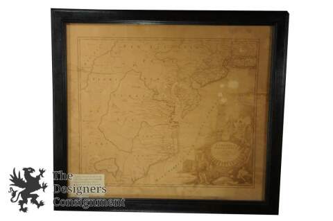
Handsome map of the mid-Atlantic colonies balanced with a pictorial cartouche filling the lower right. There is a large hypothetical lake (Apalache Lacus) west of Craven County, Carolina. Some counties and many rivers of eastern Virginia are shown, but western Virginia is vague with only Germantown, Mister Krug's Plantation and Fort Christ Anna located. Florida is shown extending west of Virginia, all the way north to Lake Erie. Maryland along Cheseapeake Bay [sic] shows many rivers and towns with soundings in most bays, and the coastline of North Carolina is fairly accurate. Philadelphia is clearly shown although Pennsylvania is divided by a rambling Sasquesahanag River and is only vaguely depicted. New Jersey is divided vertically into west and east sections. There is a large Sandy Hook, a minuscule Manhattan, and a thin Long Island Sound. The huge title cartouche depicts European merchants, Indians, trade goods, and the fruits of land and sea - imagery intended to attract people to the New World. This is the second state with the addition of privilege in the cartouche.
Johann Baptist Homann (20 March 1664 – 1 July 1724) was a German geographer and cartographer, who also made maps of the Americas.
Life
Homann was born in Oberkammlach near Kammlach in the Electorate of Bavaria. Although educated at a Jesuit school, and preparing for an ecclesiastical career, he eventually converted to Protestantism and from 1687 worked as a civil law notary in Nuremberg. He soon turned to engraving and cartography; in 1702 he founded his own publishing house.
Homann acquired renown as a leading German cartographer, and in 1715 was appointed Imperial Geographer by Emperor Charles VI. Giving such privileges to individuals was an added right that the Holy Roman Emperor enjoyed. In the same year he was also named a member of the Prussian Academy of Sciences in Berlin. Of particular significance to cartography were the imperial printing privileges (Latin: privilegia impressoria). These protected for a time the authors in all scientific fields such as printers, copper engravers, map makers and publishers. They were also very important as a recommendation for potential customers.
In 1716 Homann published his masterpiece Grosser Atlas ueber die ganze Welt (Grand Atlas of all the World). Numerous maps were drawn up in cooperation with the engraver Christoph Weigel the Elder, who also published Siebmachers Wappenbuch.
Homann died in Nuremberg. He was succeeded by the Homann heirs company, which was in business until 1848. The company was known as "Homann Erben", "Homanniani Heredes", or "Heritiers de Homann" abroad.
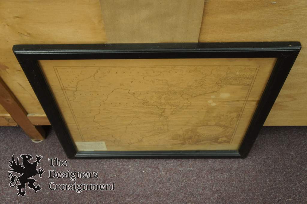
Condition
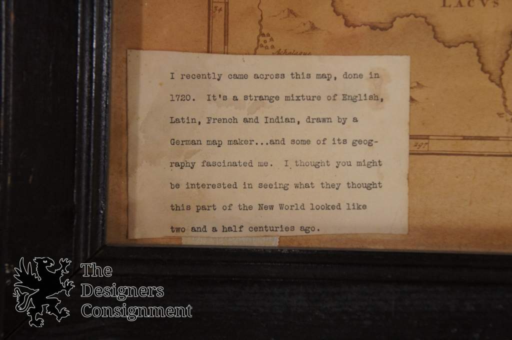
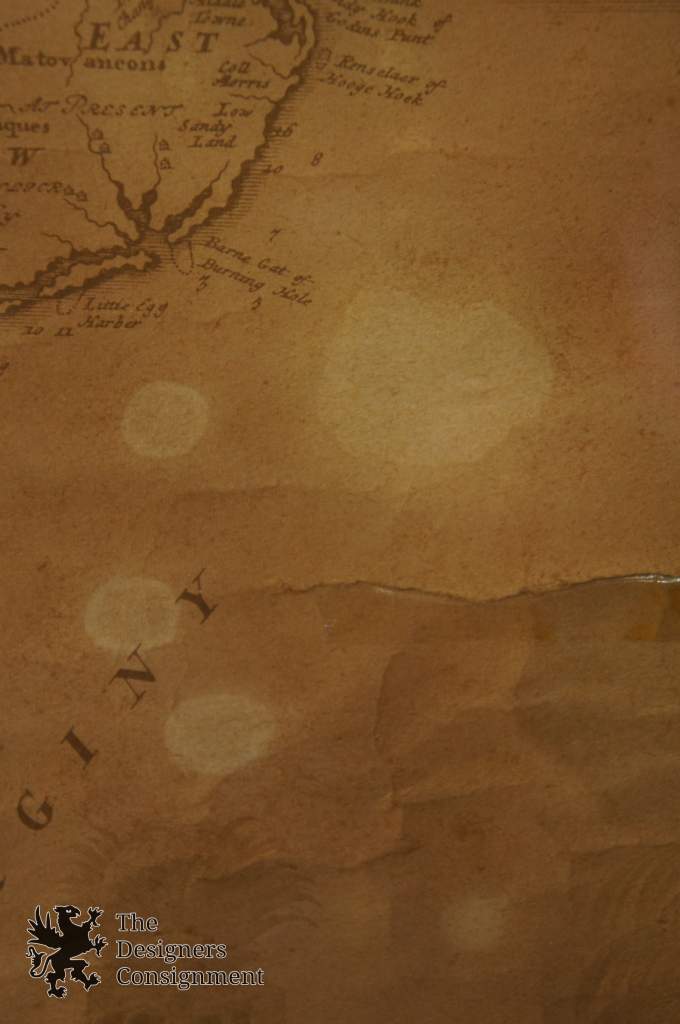
The map shows some spotting and wear. Would benefit from a restoration. Has been taped in aspot.
See Pictures for best description
Dimensions
25.5" x 28.25"
Sans Frame - 23" x 26.25"
(L x W)